Coordinate street projects and events, and gain location-based Insights helping non-technical teams reduce costs, delays, and frustration.
Learn MoreCoordinate street projects and events, and gain location-based Insights helping non-technical teams reduce costs, delays, and frustration.
Learn MoreLocationlQ combines AI assistance, street-level data, and user-friendly insights to help utilities, municipalities, and other stakeholders coordinate projects and events more effectively—without requiring technical or GIS expertise.
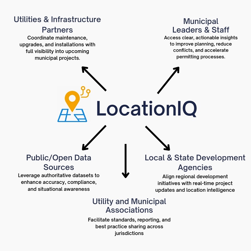
LocationIQ serves as a central clearinghouse for street planning and location-based intelligence—streamlining collaboration across all key stakeholders involved in public infrastructure and urban development.
By aggregating and connecting these sources through one intelligent platform, LocationIQ eliminates silos, reduces costly rework, and helps every stakeholder make smarter, faster decisions.

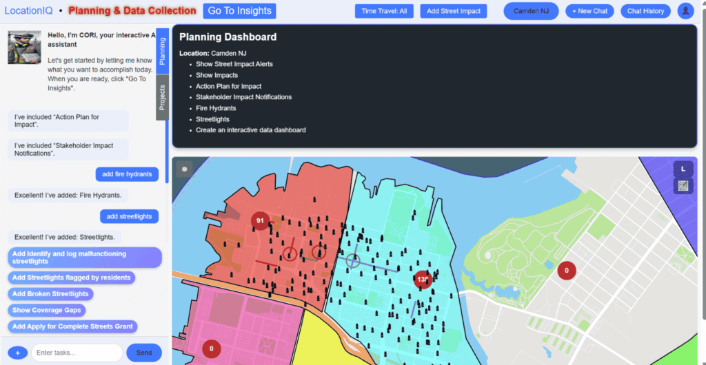
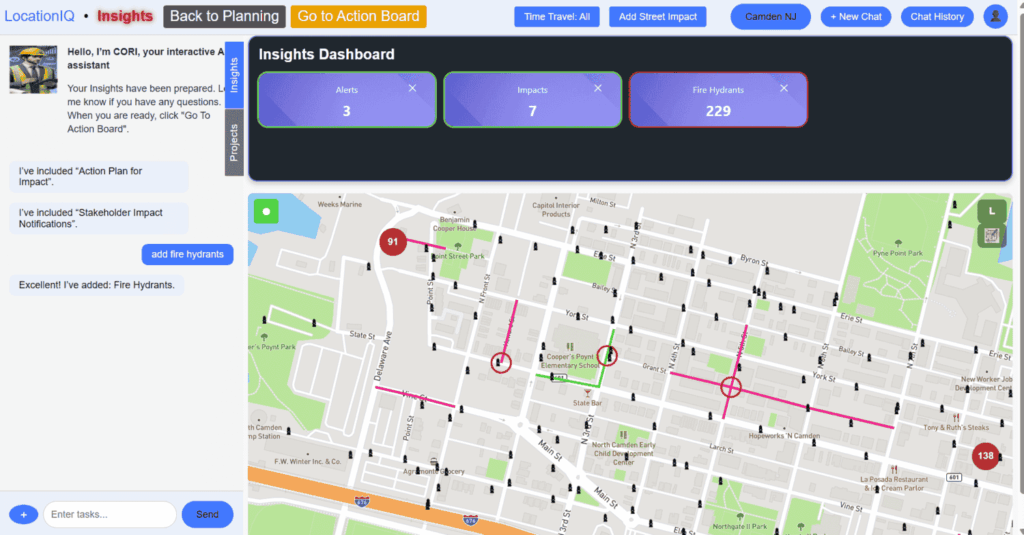
Meet CORI, your AI-powered assistant. Designed for non-technical users, CORI analyzes your input, flags risks, and recommends actions—helping you move faster, avoid conflicts, and stay ahead of coordination challenges.
Meet CORI, your AI-powered assistant. Designed for non-technical users, CORI analyzes your input, flags risks, and recommends actions—helping you move faster, avoid conflicts, and stay ahead of coordination challenges.
Input your street projects, events, or assets. CORI gathers data from partners and flags overlaps early.

CORI interprets risks and conflicts—no GIS skills needed.

Get clear, AI-powered coordination suggestions to adjust plans before issues arise.

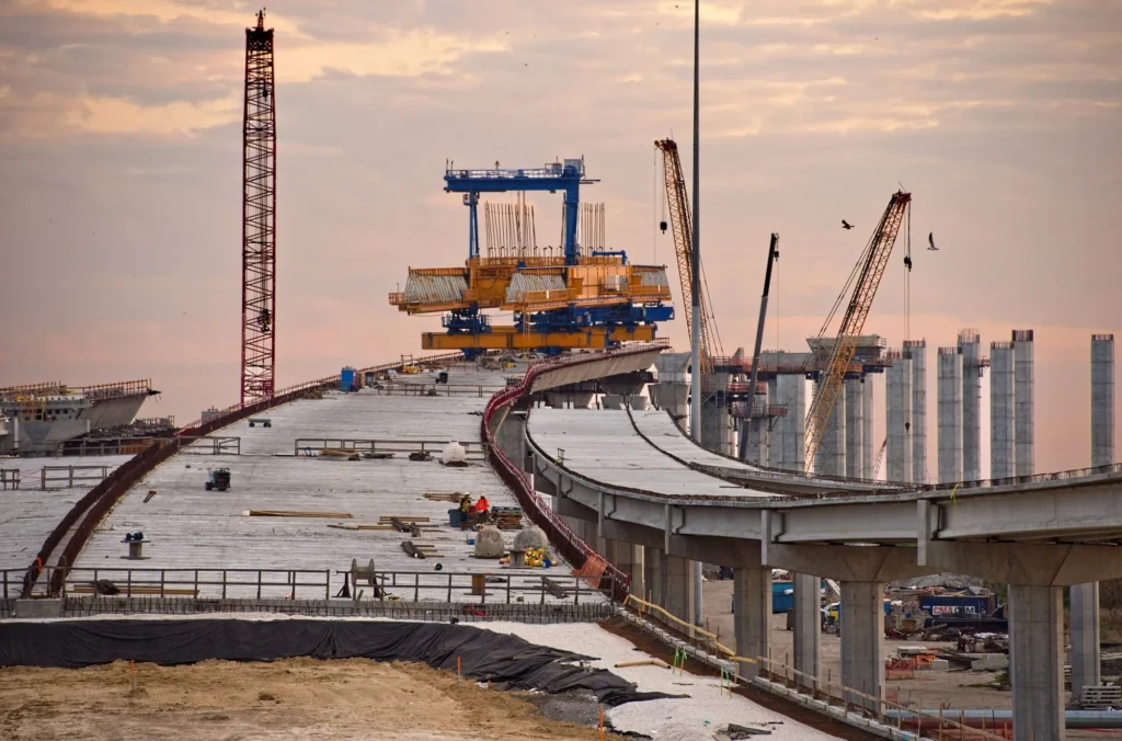
When Coordination Fails, Everyone Pays
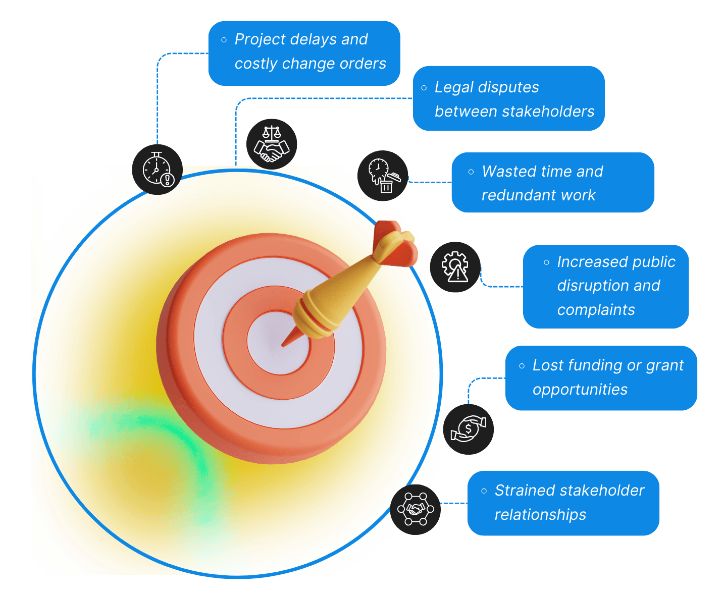
Street projects involve multiple stakeholders. Without coordination, even well-planned efforts can backfire—causing costly, avoidable issues.
To provide utilities, municipalities, and infrastructure stakeholders with an AI-powered assistant that simplifies coordination of street projects and events, reducing costs, delays, and frustration.
To create a future where data-driven collaboration improves infrastructure, enhances safety, and benefits every community.”
LocationlQ was founded to solve the persistent problem of ineffective coordination in municipal projects. Our team combined years of experience with cutting-edge AI technology to deliver a solution that works for non-technical users.